
Spring 2005
| |
|
|
| Home | Index | Museums | Blog | Authors | Site Map | About |
|
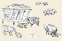
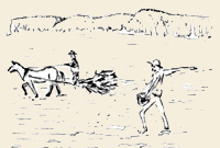
TheCherry Valley TurnpikebyRichard PalmerThe pioneers poured in from New England in droves after 1800 to settle this new land in upstate New York then known as the "Western Country," and one of the primary paths they followed was the Cherry Valley Turnpike. This road, which is more than 200 years old, is today's Route 20 from Albany to Cazenovia, and Route 92 from there to Manlius. Here it connected with the south branch of the Seneca Turnpike. Building such a lengthy road more than 70 miles long through the wilderness was a tremendous undertaking, requiring large sums of capital and manpower. Eventually, the promoters were able to secure both, but not without considerable effort and more than $100,000 in capital. The initial goal was to construct a highway from the old Revolutionary War frontier settlement of Cherry Valley, westward. The Third Great Western Turnpike Company was chartered by the State of New York Legislature in 1803, and was organized on Nov. 16th of that year. The name was derived from the fact that the First Great Western Turnpike was from Albany to Duanesburg and the Second Great Western was from there to Cherry Valley. Eventually, this system of roads was nicknamed the Cherry Valley Turnpike. Later, this name was also applied to what is now Route 20 west of Cazenovia. This section, running to Skaneateles, was never a turnpike, but a system of local roads interconnected to extend Route 20 westward in the 1930s. Benjamin Gilbert and Samuel Clemmons were formed as a committee to put the road under contract. Actual construction did not get underway for several years. The first section completed was 10 miles westward from Cherry Valley. It was accepted by a resolution passed by the board of directors on Aug. 4, 1808, and the first tollgate was constructed at Cherry Valley. Gates would be placed every 10 miles and rates of toll were established. The bridge over the west branch of the Unadilla River was contracted out to Samuel Rindge for $500, on Feb. 7, 1809. The greater part of the road appears to have been completed in December, 1809, as three more gates, including one at today's intersection of Routes 92 and 20, were ordered to be built. At a meeting held at the home of Uri Beach in Sangerfield, on Aug. 6, 1810, all seven gates for the 70 miles of the Third Great Western, were plotted and eventually built. The directors decided that wagons with tires of six or more inches in width would pass free of toll, because they kept the road packed down and reasonably free from ruts. In December, 1811, the first dividend of $12.50 per share was declared. The turnpike proved its worth and masses of people passed over it in a seemingly never-ending stream. It was not uncommon to see hundreds of covered wagons in a single day, drawn by powerful teams of horses. The road was also the impetus for opening up this region to commerce, the produce of farmers transported by heavy freight wagons to eastern markets. In all seasons, droves of cattle, sheep, hogs, geese, turkeys and other livestock shared the busy road with wagons loaded with grain, barreled beef and pork, potash and other products of the fields and forests of the western country. One long-forgotten contemporary historian wrote of this animated scene that the tide of commerce "went rolling on wheels or sliding on sleighs along its line; and through its wooded avenues and sunny clearings, over its log causeways and newly-graded hills, past its new wooden houses and log-cabins, there was a constant stream of busy life and travel." The War of 1812 brought a temporary check to emigrant travel. For about three years, government troops accompanied wagons loaded with munitions and war materials headed for the Niagara Frontier. The mass of emigration and travel gave rise to spin-off business. At one time there was a inn for every mile or two of road where travelers, wagon and stagecoach teams could rest. Our historian wrote: "We have heard it said, that the odor of the tar with which the wheels were lubricated could be perceived in the air in still weather from here (Cazenovia) to Albany." There were wayside taverns (sometimes two or even three) at Manlius, Buelleville, Oran, Cazenovia, Nelson, Togg Hill, Morrisville, Pine Woods, Madison, Sangerfield, Bridgewater, West Winfield, several at Richfield Springs, Springfield, Cherry Valley, etc. Stagecoach travel first appeared on the road in the fall of 1816, operated by a group of proprietors loosely called the "Old Line Mail." An old advertisement shows that the trip from Albany to Auburn took two days, Monday, Wednesday and Friday. Travelers had to be early risers as the stage left Albany at 2 a.m. An overnight stop was made at Cherry Valley. There were stagecoaches on the road constantly, as the "Old Line" also has competition. Each stage line also had their favorite stops. Many also traveled in their own conveyances, or on chartered stagecoaches, so as to regulate their journey to stop at their favorite "watering hole" for the night. The wayside taverns of the day boasted little of elegance, but were comfortable, with their blazing fires, clean rooms, well-spread tables, and some degree of ease. There were also several different classes of inns. While many catered to travelers, others derived their incomes from the drovers and teamsters, who were a rougher lot of people. These were prosperous times. In 1816, the Third Great Western Turnpike Company paid its investors a seven percent dividend. The stock was considered a good investment. But this was only short-lived. With the opening of the parallel Erie Canal in 1825 there came a change, and the heavy freight business soon left the wagons and took to the boats. The Mohawk Valley then became the main corridor of commerce. The route over the hills via Cherry Valley and Cazenovia, however, continued to have considerable stagecoach and private conveyance travel. It was 13 miles shorter this way to Syracuse than through the Mohawk Valley. For years it remained the favorite route of the drovers. Cattle wended their slow way, "on the hoof" from Western pastures to eastern markets. Dividends continued to be paid, but in much lower amounts. But the benefits the stockholders derived from the existence of the road far exceeded what they could expect in the way of stock dividends. By the early 1840s, however, a network of railroads later to become the New York Central was completed across the state, gradually rendering the old turnpikes obsolete. The Cherry Valley route outlived most of its contemporaries, and it was not closed as a toll road until 1857. The road did its part in the development of this country, although eventually having to yield to progress and more modern modes of transportation. Tolls collected on the road reached their highest point of $12,322 in 1815. They declined to $10,750 in 1818, and varied over the years from $4,420 to the last high of $5,700 in 1835. There was a sharp decline in 1836 after completion of the Utica & Schenectady Railroad. The railroads began to carry freight in a big way in the mid 1840s, removing the droves of cattle from the road. About that time a new wave of plank road construction began, primarily north and south, to connect to the railroads at Schenectady, Utica and Syracuse. By 1860, the old turnpike was little more than a memory, its maintenance having been turned over to local communities until it eventually became a state highway. It came back into its own with the advent of the automobile, and until the construction of the New York State Thruway in the 1950s, enjoyed a renaissance as the main east-west thoroughfare across the state. In spite of the Thruway, the road still remains popular as travelers, wearied by monotonous Interstate highways, again take to the more scenic old roads. © 2005, Richard PalmerIndex to articles by Richard F. PalmerCLR Blog | Site Map | Contact CLR |