|
|
| Home | Index | Museums | Blog | Authors | Site Map | About |
|
The Writer's Home RangeClay RoadbyThomas D. CornellOther Essays in the Writer's Home Range SeriesIve never walked to the RIT campus, though several times Ive biked in. Instead, I usually make the trip by car—and its the middle portion of my standard route home that Im thinking about now. From Bailey Road, I turn right onto West Henrietta. Although the road here is still level, Methodist Hill looms on the southern horizon, ahead of me. But just before West Henrietta starts to climb, I turn left—onto Calkins Road—which points me toward the I-390 overpass. Because the interstate follows a slight ridge, Calkins rises toward it. And, near the crest, an eastward view opens up beneath the I-beams: |
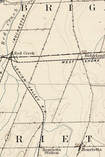 |
In the vicinity of the Calkins crossing, the tracks closely follow the creeks western bank—so that, in quick succession, I pass Middle Road (to the right), cross the tracks, and then traverse the creek bridge (the one where I ended the walk decribed in the previous essay). Just after that is a traffic light. My usual route home is straight on Calkins. Were I to turn left, however, Id find myself on what Im calling Clay Road. Except for I-390, the layout Ive just described is one that has reached our times from the nineteenth century—as can be seen in the detail from the 1893 USGS topo map of Rochester.1 Although not labeled, Clay Road runs at an oblique angle, from Calkins Road to Brighton-Henrietta Townline Road at Ridgeland. The development of Henrietta after World War II has made the terrain considerably more complex. But the basic grid dates back more than a century. Something about the roads oblique angle catches my attention. It isnt unique to Clay Road. It can also be seen in the Erie Railroad and West Henrietta Road. But it does stand out, as a departure from the north-south arrangement preferred by early planners. |
Perhaps it goes all the way back to the Phelps-Gorham Purchase of 1788. In their negotiations with the Iroquois, Oliver Phelps and Nathaniel Gorham were keen to have the tract include at least some land west of the Genesee—to allow for millsites on that side of the river. Although the Iroquois resisted, they finally agreed to a limited strip, extending southwest from the Lake Ontario and paralleling the river for some 24 miles.2
Thus the angle followed by Clay Road may echo a compromise involving (a) the desire of European Americans for industrial development (in the form of gristmills and sawmills), (b) the desire of Native Americans for minimizing their loss of autonomy (by placing limits on their land cession), and (c) the general direction in which the Genesee River flows into Lake Ontario.
Whatever the case, the fact that Clay Road has an out-of-the-ordinary direction reminded me of a passage in the opening essay of A Sand County Almanac. When Januarys bitter cold moderated enough to produce a brief thaw, Leopold set out to explore his farm along the banks of the Wisconsin River. Some of the things he observed had obvious explanations. For example, when he caught sight of a field mouse, he realized that the rising temperatures had exposed its tunnels under the snow. In the case of the rabbit that had nibbled the bark of seedling oaks, Leopold didnt see the creature itself. But wing marks around a bloody spot in the snow suggested its likely demise—as a meal for an owl.
By contrast, a skunks trail across the snow across was a puzzle. Like Clay Road on the 1893 map, it followed an undeviating course for a purpose that was difficult for Leopold to fathom. [The path] leads straight across-country, he wrote, as if its maker had hitched his wagon to a star and dropped the reins.3 Although he could imagine several possible explanations, he wasnt comfortable with committing himself to any of them. Thus he returned home still wondering.4
 |
I admire Leopolds ability to read the natural landscape. I also admire his willingness to acknowledge (at least, temporarily) the incompleteness of his knowledge. As a result, I felt encouraged to proceed with my exploration of Clay Road, despite the things about it I still didnt know—or wasnt sure about. Clay Road—along with I-390 (to the north), East Henrietta (to the east), and Calkins (to the south)—serves as one of the main boundaries of our subdivision. Unlike the others, however, Clay has become a relic road. Dismembered by recent developments, its bits and pieces still exist, but they no longer constitute a functional whole. Beginning with its southern terminus at Calkins, the road today5 boasts an impressive five lanes of asphalt. But the label it carries isnt Clay Road. Its Hylan Drive—in honor of Ray Hylan, one of the developers of Marketplace Mall and the owner of the airfield that once occupied the mall site. Although the surrounding terrrain is basically level, there do exist slight variations in its contours. One of these is a slight rise just north of Calkins, from which I took a picture in May 2003—looking northeast: |
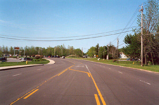
Where Hylan angles off to the left, the entrance to our subdivision—and the original route of Clay Road—keeps going. Summer Sky, the turnoff is now called, making it one of the most pleasing street names I see on a daily basis.
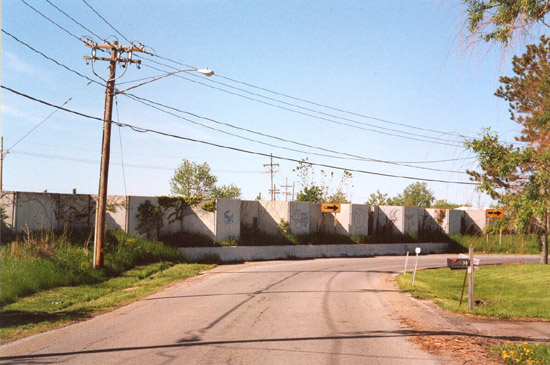
The point of the picture is to demonstrate that the first leg of Hylan and the first leg of Summer Sky are both on a line—namely, the route of old Clay Road. This stretch even includes two houses from the nineteenth century. But a more imposing feature is Summer Skys abrupt turn at the barrier marking the edge of I-390. Beyond those concrete slabs is a never-ending stream of traffic, whose roar is often audible at our house:
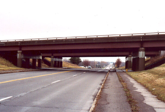
For a direct look at I-390—and to continue my drive—I doubled back and proceeded along Hylan, as it angles toward the mall and the crosses the interstate:
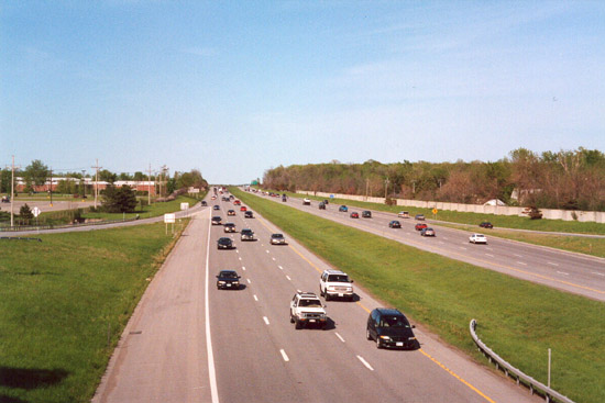
With reference to that view from the overpass, Clay Road once extended from the houses in the trees on the right, to the Clayton Arms Apartments on the left.
Of course, it was the construction of I-390 that reshaped Clay Road so dramatically. Tying New Yorks Southern Tier to Rochester, this portion of the nations interstate system had just been completed when I moved to Rochester in 1982 (thus facilitating regular trips to visit my grandmother). Although the 14.5-mile section from Avon to Henrietta—ending at the Hylan Drive exit—was opened in 1980, the planning had begun much earlier. In 1969, the developers of what later became Marketplace Mall gave the county the right-of-way (and a portion of the construction costs, as well) to reroute Clay Road—with todays Hylan Drive being the result.
The road that resumes immediately north of I-390 is still called Clay Road, and on my drive I put myself at its southern end for the first time:
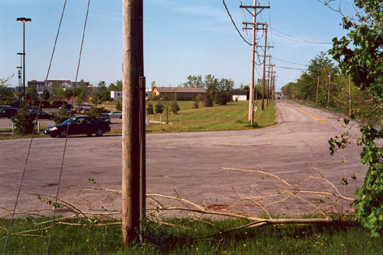
Although the Clayton Arms Apartments dont appear in the photo, they are situated to the right. To the left (beyond my car) can be seen the parking lot for Walmart (with the store itself being situated even further to the left, beyond the frame of the picture).
From there I drove a couple blocks, crossed Jefferson Road, and then continued a couple blocks more. But then I reached another deadend:
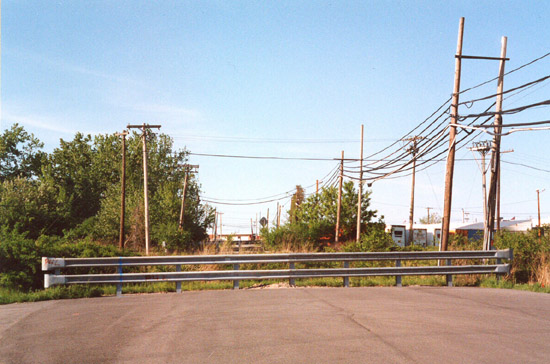
This time, what sliced through the road was the railbed for the old West Shore Railroad—which now carries regular CSX traffic—so that along with highway sounds from the interstate, in my neighborhood we also hear the distant whistles of occasional freight trains.
Since this part of my drive was new to me, I parked at the deadend and explored on foot. What I discovered was a siding off the mainline:
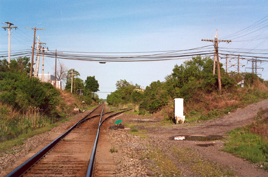
Although its tracks dont currently extend much further than what can be seen in the picture, the siding once turned into the Genesee Valley Regional Market. When built in the mid-1950s, the market was intended to facilitate the distribution of farm produce in Western New York, via both trains and trucks. Today the market has lost its rail access, and its commercial establishments are more varied—including Loris Natural Foods Center, where Terry and I shop for groceries each week.
Finally, I made my way to Brighton-Henrietta Townline Road—which once marked Clay Roads northern terminus. On my drive, however, I noted that the short segment north of the CSX tracks is called Gravely Road. At its intersection with Brighton-Henrietta Townline Road, what caught my attention was the view of the skyscrapers downtown. Finding myself on terrain high enough for long-distance views helped me understand the appropriateness of the designation Ridgeland on the maps I had consulted.
Where Clay Roads northern end is anchored in the view of the skyscrapers downtown, its southern end is anchored in a much more immediate view, namely, Henriettas public library and town hall, just a short distance east on Calkins. Although Ive never had occasion to visit the town hall, Ive been to the library on many occasions—sometimes even walking there from our house. In fact, as part of this project I used some of the librarys local history material to find out more about Clay Road, and in the process I unexpectedly stumbled onto a future development.
Green Light Is Given for Traffic-relief Plan, read a recent headline in the Henrietta Post.6 What the article went on to report was a unanimous vote by the town board to reconnect two of the segments Ive just described: The project will extend Clay Road into what is now Gravely Drive. By building a new bridge over the CSX railroad tracks, drivers will be able to cross from Jefferson to Brighton-Henrietta Townline Road without having to brave traffic on East or West Henrietta roads. Thus I learned that at least one of the late-twentieth century cuts in old Clay Road was slated for restoration.
1 See http://docs.unh.edu/NY/rstr95sw.jpg. The map is part of the online collection Historic USGS Maps of New England & New York offered by the University of New Hampshire Library.
2 For a brief account, see http://en.wikipedia.org/wiki/The_Triangle_Tract (the Wikipedia entry on The Triangle Tract). I first accessed this site in July 2007.
3 Aldo Leopold, A Sand County Almanac and Sketches Here and There (New York: Oxford University Press, 1949), p. 3 (in the essay January Thaw).
4 Ibid., p. 5.
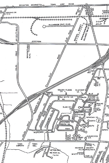
5 The illustration shows a portion of a Town of Henrietta map (no date, but probably the late 1970s), available in the local history collection at the Henrietta Public Library.
6 Eric Walker, 24 September 2003, p. 3A.
